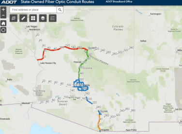
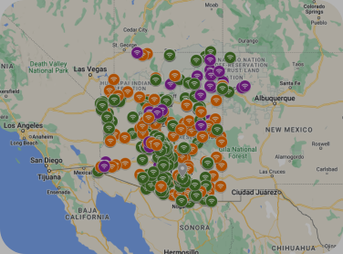
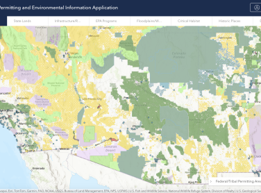
Select An Audience
CORI - Broadband Map Thumbnail

CORI - Interactive Rural Broadband Service Map

This map from The Center on Rural Innovation (CORI) allows potential BEAD applicants to explore eligible project areas, view project areas funded by previous federal grants, and easily see existing ISP footprints in potential deployment areas. The tool is designed to support efficient initial assessments of eligibility by census block, and the creation of a high-level grant strategy based on that eligibility.

Explore The Map
Image of the Map of Free Wifi areas

Connect Arizona's Free Public Wi-Fi Map

The locations on this map represent free public wi-fi hotspots at public libraries, schools, businesses, and other sites. Some sites may offer indoor public access during business hours, others provide access in the parking lot only.

Learn More

Esri

Esri is the global market leader in geographic information system (GIS) software, location intelligence, and mapping. Esri supports geographic approach to problem-solving, brought to life by modern, enterprise-grade GIS technology. They are committed to using science and technology to build a sustainable world.

Learn more

Connect All Arizona

Under the leadership of Arizona Governor Katie Hobbs, the State Broadband Office is pleased to announce ConnectAllAZ – a statewide initiative to deploy historic investments into broadband connectivity, giving Arizona residents access to reliable, high-speed internet.

Learn more

N50 Project

The N50 Project accelerates digital adoption and community enrichment through innovative applications, network design, and business models to enable the next 3 billion people to participate in the digital world. 

Learn more